Checked
Ottawa neighbourhoods: a guide to the main areas
Ottawa, Ontario, Canada
A factual guide to Ottawa, Ontario's main areas and all 24 wards: where they are, 2021 census population, housing, language, libraries, parks, recreation centres, schools and O-Train stations.
Key information
Ottawa has 24 wards and 116 statistical neighbourhoods. Downtown, Centretown, the ByWard Market and the Glebe are dense and mostly rented apartments. Inner areas like Westboro, Hintonburg and New Edinburgh mix houses and apartments. Kanata, Stittsville, Barrhaven, Riverside South and Orléans are suburbs of mostly detached and townhouses, and the rural wards are villages and farms. Find your ward with the City's ward map.
On this page
How Ottawa is divided
Ottawa reaches from the downtown core on the Ottawa River to farms and rural villages. In the 2021 census it had about 1,017,450 residents in 407,250 occupied homes (City custom census tabulation of Statistics Canada data).
The City uses several official ways to divide it. There are 24 wards, each with one councillor. The Ottawa Neighbourhood Study splits the city into 116 neighbourhoods for statistics. The Official Plan groups land into transects from the Downtown Core outward through Inner Urban, Outer Urban, Suburban, Greenbelt and Rural, and names 26 villages in the rural area.
This guide groups the 24 wards into eight main areas and gives facts for each ward: population, housing, language, libraries, parks, recreation centres, schools and O-Train stations. Census figures are from 2021 and come from the City's open ward data.
Sources: Wards open data layer, City of Ottawa · Ottawa Neighbourhood Study boundaries Gen 3, Open Ottawa · Official Plan transect policy areas, Open Ottawa · Official Plan village boundaries, City of Ottawa · 2021 Short Form Census, Ward Data, Open Ottawa
Ottawa's main areas at a glance
| Ward | Main area | Population | Single-detached | Apartments 5+ storeys | Renters | French first official language |
|---|---|---|---|---|---|---|
| Somerset (14) | Downtown and the central neighbourhoods | 40,805 | 4% | 61% | 75% | 12% |
| Rideau-Vanier (12) | Downtown and the central neighbourhoods | 45,910 | 7% | 39% | 73% | 28% |
| Capital (17) | Downtown and the central neighbourhoods | 37,790 | 26% | 34% | 52% | 10% |
| Kitchissippi (15) | Inner west and inner east | 37,765 | 30% | 31% | 49% | 9% |
| Rideau-Rockcliffe (13) | Inner west and inner east | 38,565 | 22% | 26% | 55% | 29% |
| River (16) | Inside the Greenbelt: south and east | 46,675 | 34% | 28% | 46% | 10% |
| Alta Vista (18) | Inside the Greenbelt: south and east | 45,060 | 44% | 35% | 49% | 15% |
| Gloucester-Southgate (10) | Inside the Greenbelt: south and east | 48,860 | 30% | 15% | 40% | 12% |
| Beacon Hill-Cyrville (11) | Inside the Greenbelt: south and east | 34,640 | 31% | 16% | 34% | 24% |
| Bay (7) | Inside the Greenbelt: west end | 49,615 | 28% | 46% | 55% | 8% |
| College (8) | Inside the Greenbelt: west end | 51,955 | 46% | 14% | 35% | 7% |
| Knoxdale-Merivale (9) | Inside the Greenbelt: west end | 40,360 | 42% | 16% | 39% | 7% |
| Kanata North (4) | Kanata and Stittsville | 42,140 | 44% | 11% | 26% | 6% |
| Kanata South (23) | Kanata and Stittsville | 49,800 | 49% | 1% | 15% | 6% |
| Stittsville (6) | Kanata and Stittsville | 45,565 | 67% | 1% | 16% | 6% |
| Barrhaven West (3) | Barrhaven, Riverside South and Findlay Creek | 50,130 | 56% | 1% | 15% | 7% |
| Barrhaven East (24) | Barrhaven, Riverside South and Findlay Creek | 50,745 | 47% | 1% | 22% | 7% |
| Riverside South-Findlay Creek (22) | Barrhaven, Riverside South and Findlay Creek | 33,120 | 54% | 0% | 13% | 9% |
| Orléans East-Cumberland (1) | Orléans and the east end | 49,425 | 61% | 3% | 11% | 32% |
| Orléans West-Innes (2) | Orléans and the east end | 46,470 | 55% | 2% | 17% | 28% |
| Orléans South-Navan (19) | Orléans and the east end | 49,835 | 54% | 0% | 16% | 32% |
| West Carleton-March (5) | Rural Ottawa and the villages | 24,755 | 96% | 0% | 6% | 5% |
| Rideau-Jock (21) | Rural Ottawa and the villages | 27,280 | 93% | 0% | 9% | 6% |
| Osgoode (20) | Rural Ottawa and the villages | 30,185 | 91% | 1% | 9% | 13% |
City-wide in 2021: 42% of homes were single-detached houses, 19% were apartments in buildings of five or more storeys, 36% of households rented, 36% of residents spoke both English and French, and 14% had French as their first official language.
Sources: 2021 Short Form Census, Ward Data, Open Ottawa · 2021 Long Form Census, Ward Data, Open Ottawa
Population by main area
- Downtown and the central neighbourhoods124,505 residents
- Inner west and inner east76,330 residents
- Inside the Greenbelt: south and east175,235 residents
- Inside the Greenbelt: west end141,930 residents
- Kanata and Stittsville137,505 residents
- Barrhaven, Riverside South and Findlay Creek133,995 residents
- Orléans and the east end145,730 residents
- Rural Ottawa and the villages82,220 residents
Downtown and the central neighbourhoods
Somerset, Rideau-Vanier and Capital cover downtown, Centretown, the ByWard Market, Lowertown, Sandy Hill, Vanier, the Glebe and Old Ottawa South and East. In all three wards most homes are apartments and more than half of households rent (52% to 75% in 2021). Most O-Train Line 1 stations and the north end of Line 2 are in these wards.
Somerset (ward 14)
Somerset ward, Ottawa, Ontario
Somerset (ward 14) had 40,805 residents in the 2021 census. Its Ottawa Neighbourhood Study areas include Centretown, Lebreton Development and West Centretown.
Housing: 4% of homes are single-detached houses, 5% are row houses and 61% are apartments in buildings of five or more storeys. 75% of households rent.
Services in the ward: 1 library branch (Main branch); 17 City park records; 4 City recreation complexes and community centres; 15 schools.
O-Train stations in the ward: Bayview, Lyon, Parliament, Pimisi, Corso Italia, Dow's Lake.
Business improvement areas centred here: Somerset-Chinatown, Preston Street, Somerset Village, Downtown, Centretown.
- Population (2021 census)
- 40,805
- Private dwellings (2021)
- 25,155
- Median age
- 35.2
- Children 0 to 14
- 7%
- Single-detached homes
- 4%
- Apartments, 5+ storeys
- 61%
- Renter households
- 75%
- French first official language
- 12%
- Speak English and French
- 0%
- City park records
- 17
- Schools (all boards)
- 15
- Recreation complexes and community centres
- Jack Purcell Community Centre, McNabb Community Centre, Plant Recreation Centre, St Lukes Community Centre: Bethell Fieldhouse
Sources: 2021 Short Form Census, Ward Data, Open Ottawa · 2021 Long Form Census, Ward Data, Open Ottawa · Wards open data layer, City of Ottawa · Ottawa Neighbourhood Study boundaries Gen 3, Open Ottawa · Parks and Greenspace open data layer, City of Ottawa · Schools open data layer, City of Ottawa · City facilities: recreation layer, City of Ottawa · Find an OPL branch, Ottawa Public Library
Rideau-Vanier (ward 12)
Rideau-Vanier ward, Ottawa, Ontario
Rideau-Vanier (ward 12) had 45,910 residents in the 2021 census. Its Ottawa Neighbourhood Study areas include Vanier North, Vanier South, Lowertown West, Sandy Hill, Lowertown East and Beechwood Cemetery.
Housing: 7% of homes are single-detached houses, 7% are row houses and 39% are apartments in buildings of five or more storeys. 73% of households rent.
Services in the ward: 2 library branches (Rideau branch, Vanier branch); 41 City park records; 4 City recreation complexes and community centres; 17 schools.
O-Train stations in the ward: Rideau, uOttawa.
Business improvement areas centred here: Vanier, Downtown Rideau.
- Population (2021 census)
- 45,910
- Private dwellings (2021)
- 24,785
- Median age
- 37.2
- Children 0 to 14
- 10%
- Single-detached homes
- 7%
- Apartments, 5+ storeys
- 39%
- Renter households
- 73%
- French first official language
- 28%
- Speak English and French
- 0%
- City park records
- 41
- Schools (all boards)
- 17
- District parks
- Bernard-Grandmaître Arena
- Recreation complexes and community centres
- Lowertown Cmplx, Richelieu-Vanier Community Centre, Routhier Community Centre, Sandy Hill Community Centre
Sources: 2021 Short Form Census, Ward Data, Open Ottawa · 2021 Long Form Census, Ward Data, Open Ottawa · Wards open data layer, City of Ottawa · Ottawa Neighbourhood Study boundaries Gen 3, Open Ottawa · Parks and Greenspace open data layer, City of Ottawa · Schools open data layer, City of Ottawa · City facilities: recreation layer, City of Ottawa · Find an OPL branch, Ottawa Public Library
Capital (ward 17)
Capital ward, Ottawa, Ontario
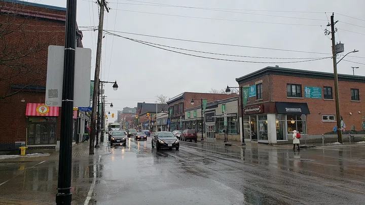
Capital (ward 17) had 37,790 residents in the 2021 census. Its Ottawa Neighbourhood Study areas include Glebe - Dows Lake, Carleton University, Old Ottawa South, Old Ottawa East and Billings Bridge - Huron Park.
Housing: 26% of homes are single-detached houses, 8% are row houses and 34% are apartments in buildings of five or more storeys. 52% of households rent.
Services in the ward: 1 library branch (Sunnyside branch); 38 City park records; 3 City recreation complexes and community centres; 16 schools.
O-Train stations in the ward: Carleton, Hurdman, Lees.
Business improvement areas centred here: Glebe.
- Population (2021 census)
- 37,790
- Private dwellings (2021)
- 17,560
- Median age
- 38.4
- Children 0 to 14
- 11%
- Single-detached homes
- 26%
- Apartments, 5+ storeys
- 34%
- Renter households
- 52%
- French first official language
- 10%
- Speak English and French
- 0%
- City park records
- 38
- Schools (all boards)
- 16
- District parks
- Brewer Park
- Recreation complexes and community centres
- Glebe Community Centre, Old Town Hall Community Centre, Ottawa South Community Centre
Sources: 2021 Short Form Census, Ward Data, Open Ottawa · 2021 Long Form Census, Ward Data, Open Ottawa · Wards open data layer, City of Ottawa · Ottawa Neighbourhood Study boundaries Gen 3, Open Ottawa · Parks and Greenspace open data layer, City of Ottawa · Schools open data layer, City of Ottawa · City facilities: recreation layer, City of Ottawa · Find an OPL branch, Ottawa Public Library
Sources: 2021 Short Form Census, Ward Data, Open Ottawa · 2021 Long Form Census, Ward Data, Open Ottawa · Wards open data layer, City of Ottawa · Ottawa Neighbourhood Study boundaries Gen 3, Open Ottawa
Inner west and inner east
Kitchissippi (Westboro, Hintonburg, Wellington Village, Civic Hospital) sits west of downtown and Rideau-Rockcliffe (New Edinburgh, Rockcliffe Park, Manor Park, Overbrook, Wateridge Village) sits east. Both have a mix of housing: in 2021, 30% and 22% of homes were single-detached and 31% and 26% were in buildings of five or more storeys. Wellington West and Westboro Village are the business improvement areas in Kitchissippi.
Kitchissippi (ward 15)
Kitchissippi ward, Ottawa, Ontario
Kitchissippi (ward 15) had 37,765 residents in the 2021 census. Its Ottawa Neighbourhood Study areas include Island Park - Wellington Village, Hintonburg - Mechanicsville, Civic Hospital and Westboro.
Housing: 30% of homes are single-detached houses, 4% are row houses and 31% are apartments in buildings of five or more storeys. 49% of households rent.
Services in the ward: 1 library branch (Rosemount branch); 35 City park records; 5 City recreation complexes and community centres; 19 schools.
O-Train stations in the ward: Tunney's Pasture.
Business improvement areas centred here: Wellington West, Westboro Village.
- Population (2021 census)
- 37,765
- Private dwellings (2021)
- 18,260
- Median age
- 40.4
- Children 0 to 14
- 14%
- Single-detached homes
- 30%
- Apartments, 5+ storeys
- 31%
- Renter households
- 49%
- French first official language
- 9%
- Speak English and French
- 0%
- City park records
- 35
- Schools (all boards)
- 19
- Recreation complexes and community centres
- Churchill Senior Recreation Centre, Dovercourt Recreation Centre, Fisher Park Community Centre, Hintonburg Community Centre, Wellington Street Seniors Centre
Sources: 2021 Short Form Census, Ward Data, Open Ottawa · 2021 Long Form Census, Ward Data, Open Ottawa · Wards open data layer, City of Ottawa · Ottawa Neighbourhood Study boundaries Gen 3, Open Ottawa · Parks and Greenspace open data layer, City of Ottawa · Schools open data layer, City of Ottawa · City facilities: recreation layer, City of Ottawa · Find an OPL branch, Ottawa Public Library
Rideau-Rockcliffe (ward 13)
Rideau-Rockcliffe ward, Ottawa, Ontario
Rideau-Rockcliffe (ward 13) had 38,565 residents in the 2021 census. Its Ottawa Neighbourhood Study areas include Overbrook, Wateridge Village, New Edinburgh, Rockcliffe Park and Manor Park.
Housing: 22% of homes are single-detached houses, 22% are row houses and 26% are apartments in buildings of five or more storeys. 55% of households rent.
Services in the ward: 2 library branches (Rockcliffe Park branch, St-Laurent branch); 39 City park records; 5 City recreation complexes and community centres; 23 schools.
O-Train stations in the ward: St-Laurent.
- Population (2021 census)
- 38,565
- Private dwellings (2021)
- 17,350
- Median age
- 44
- Children 0 to 14
- 14%
- Single-detached homes
- 22%
- Apartments, 5+ storeys
- 26%
- Renter households
- 55%
- French first official language
- 29%
- Speak English and French
- 0%
- City park records
- 39
- Schools (all boards)
- 23
- District parks
- Raymond Chabot Grant Thorton Park
- Recreation complexes and community centres
- Linden Lea Community Centre, Manor Park Community Centre, Overbrook Community Centre, Rockcliffe Park Community Centre, St. Laurent Complex/Don Gamble Community Centre
Sources: 2021 Short Form Census, Ward Data, Open Ottawa · 2021 Long Form Census, Ward Data, Open Ottawa · Wards open data layer, City of Ottawa · Ottawa Neighbourhood Study boundaries Gen 3, Open Ottawa · Parks and Greenspace open data layer, City of Ottawa · Schools open data layer, City of Ottawa · City facilities: recreation layer, City of Ottawa · Find an OPL branch, Ottawa Public Library
Sources: 2021 Short Form Census, Ward Data, Open Ottawa · 2021 Long Form Census, Ward Data, Open Ottawa · Wards open data layer, City of Ottawa · Ottawa Neighbourhood Study boundaries Gen 3, Open Ottawa
Inside the Greenbelt: south and east
River, Alta Vista, Gloucester-Southgate and Beacon Hill-Cyrville cover the south and east of the city inside the Greenbelt, from Carlington and Mooney's Bay to Hunt Club, Elmvale, Blossom Park and Beacon Hill. Housing is mixed: 30% to 44% of homes are single-detached and 15% to 35% are in buildings of five or more storeys. The Airport, South Keys and Greenboro stations (Lines 2 and 4) and Blair station (Line 1) are in this area.
River (ward 16)
River ward, Ottawa, Ontario
River (ward 16) had 46,675 residents in the 2021 census. Its Ottawa Neighbourhood Study areas include Riverside Park South - Revelstoke, Experimental Farm, Riverside Park - Mooney's Bay, Carlington, Carleton Heights - Courtland Park and Old Hunt Club.
Housing: 34% of homes are single-detached houses, 24% are row houses and 28% are apartments in buildings of five or more storeys. 46% of households rent.
Services in the ward: no library branch inside the ward boundary; 45 City park records; 5 City recreation complexes and community centres; 22 schools.
O-Train stations in the ward: Mooney's Bay, Walkley.
- Population (2021 census)
- 46,675
- Private dwellings (2021)
- 19,600
- Median age
- 39.2
- Children 0 to 14
- 15%
- Single-detached homes
- 34%
- Apartments, 5+ storeys
- 28%
- Renter households
- 46%
- French first official language
- 10%
- Speak English and French
- 0%
- City park records
- 45
- Schools (all boards)
- 22
- District parks
- Ledbury Park and Pavilion, Mooney's Bay Park
- Recreation complexes and community centres
- Alexander CC, Carleton Heights CC, Carlington Rec Centre & Gym, Hunt Club-Riverside Park Community Centre, Terry Fox Main Building
Sources: 2021 Short Form Census, Ward Data, Open Ottawa · 2021 Long Form Census, Ward Data, Open Ottawa · Wards open data layer, City of Ottawa · Ottawa Neighbourhood Study boundaries Gen 3, Open Ottawa · Parks and Greenspace open data layer, City of Ottawa · Schools open data layer, City of Ottawa · City facilities: recreation layer, City of Ottawa · Find an OPL branch, Ottawa Public Library
Alta Vista (ward 18)
Alta Vista ward, Ottawa, Ontario
Alta Vista (ward 18) had 45,060 residents in the 2021 census. Its Ottawa Neighbourhood Study areas include Elmvale - Canterbury, Alta Vista, Hawthorne Meadows - Sheffield Glen, Playfair Park - Guildwood Estates and Riverview.
Housing: 44% of homes are single-detached houses, 11% are row houses and 35% are apartments in buildings of five or more storeys. 49% of households rent.
Services in the ward: 2 library branches (Alta Vista branch, Elmvale Acres branch); 39 City park records; 4 City recreation complexes and community centres; 22 schools.
O-Train stations in the ward: Tremblay.
- Population (2021 census)
- 45,060
- Private dwellings (2021)
- 18,805
- Median age
- 39.6
- Children 0 to 14
- 16%
- Single-detached homes
- 44%
- Apartments, 5+ storeys
- 35%
- Renter households
- 49%
- French first official language
- 15%
- Speak English and French
- 0%
- City park records
- 39
- Schools (all boards)
- 22
- District parks
- Lynda Lane Park
- Recreation complexes and community centres
- Canterbury Community Centre, Dempsey CC, Heron Rd Multi-Service Cntr., Jim Durrell Recreation Centre
Sources: 2021 Short Form Census, Ward Data, Open Ottawa · 2021 Long Form Census, Ward Data, Open Ottawa · Wards open data layer, City of Ottawa · Ottawa Neighbourhood Study boundaries Gen 3, Open Ottawa · Parks and Greenspace open data layer, City of Ottawa · Schools open data layer, City of Ottawa · City facilities: recreation layer, City of Ottawa · Find an OPL branch, Ottawa Public Library
Gloucester-Southgate (ward 10)
Gloucester-Southgate ward, Ottawa, Ontario
Gloucester-Southgate (ward 10) had 48,860 residents in the 2021 census. Its Ottawa Neighbourhood Study areas include Emerald Woods - Sawmill Creek, Ledbury - Heron Gate - Ridgemont, Greenboro West, Blossom Park - Timbermill, Greenboro East, South Keys, Industrial East, Airport, Greenbelt East and Hunt Club Park.
Housing: 30% of homes are single-detached houses, 42% are row houses and 15% are apartments in buildings of five or more storeys. 40% of households rent.
Services in the ward: 1 library branch (Greenboro branch); 62 City park records; 2 City recreation complexes and community centres; 18 schools.
O-Train stations in the ward: Greenboro, South Keys, Airport, Uplands.
- Population (2021 census)
- 48,860
- Private dwellings (2021)
- 17,965
- Median age
- 37.2
- Children 0 to 14
- 18%
- Single-detached homes
- 30%
- Apartments, 5+ storeys
- 15%
- Renter households
- 40%
- French first official language
- 12%
- Speak English and French
- 0%
- City park records
- 62
- Schools (all boards)
- 18
- District parks
- Ottawa Business Park
- Recreation complexes and community centres
- Albion Heatherington Community Centre, Diane Deans Greenboro Community Centre
Sources: 2021 Short Form Census, Ward Data, Open Ottawa · 2021 Long Form Census, Ward Data, Open Ottawa · Wards open data layer, City of Ottawa · Ottawa Neighbourhood Study boundaries Gen 3, Open Ottawa · Parks and Greenspace open data layer, City of Ottawa · Schools open data layer, City of Ottawa · City facilities: recreation layer, City of Ottawa · Find an OPL branch, Ottawa Public Library
Beacon Hill-Cyrville (ward 11)
Beacon Hill-Cyrville ward, Ottawa, Ontario
Beacon Hill-Cyrville (ward 11) had 34,640 residents in the 2021 census. Its Ottawa Neighbourhood Study areas include Carson Grove - Carson Meadows, Pineview, Beacon Hill South - Cardinal Heights and Rothwell Heights - Beacon Hill North.
Housing: 31% of homes are single-detached houses, 36% are row houses and 16% are apartments in buildings of five or more storeys. 34% of households rent.
Services in the ward: 1 library branch (North Gloucester branch); 49 City park records; 4 City recreation complexes and community centres; 15 schools.
O-Train stations in the ward: Blair, Cyrville.
- Population (2021 census)
- 34,640
- Private dwellings (2021)
- 13,450
- Median age
- 41.2
- Children 0 to 14
- 16%
- Single-detached homes
- 31%
- Apartments, 5+ storeys
- 16%
- Renter households
- 34%
- French first official language
- 24%
- Speak English and French
- 0%
- City park records
- 49
- Schools (all boards)
- 15
- District parks
- Richcraft Sensplex (Ottawa East), Shefford Sports Park
- Recreation complexes and community centres
- Beacon Hill CC & Change House, Pat Clark Community Centre, Pineview Community Hub, Richcraft Sensplex (Ottawa East)
Sources: 2021 Short Form Census, Ward Data, Open Ottawa · 2021 Long Form Census, Ward Data, Open Ottawa · Wards open data layer, City of Ottawa · Ottawa Neighbourhood Study boundaries Gen 3, Open Ottawa · Parks and Greenspace open data layer, City of Ottawa · Schools open data layer, City of Ottawa · City facilities: recreation layer, City of Ottawa · Find an OPL branch, Ottawa Public Library
Sources: 2021 Short Form Census, Ward Data, Open Ottawa · 2021 Long Form Census, Ward Data, Open Ottawa · Wards open data layer, City of Ottawa · Ottawa Neighbourhood Study boundaries Gen 3, Open Ottawa
Inside the Greenbelt: west end
Bay, College and Knoxdale-Merivale cover the west end inside the Greenbelt, from Britannia and Bayshore to Centrepointe, Bells Corners and Merivale. Bay has the second-highest share of homes in buildings of five or more storeys (46%), after Somerset. College had the most residents of any ward in 2021.
Bay (ward 7)
Bay ward, Ottawa, Ontario
Bay (ward 7) had 49,615 residents in the 2021 census. Its Ottawa Neighbourhood Study areas include Queensway Terrace North, Laurentian, Bayshore, Crystal Bay - Lakeview Park, Britannia and Whitehaven - Woodpark - Glabar Park.
Housing: 28% of homes are single-detached houses, 11% are row houses and 46% are apartments in buildings of five or more storeys. 55% of households rent.
Services in the ward: 1 library branch (Carlingwood branch); 36 City park records; 3 City recreation complexes and community centres; 25 schools.
- Population (2021 census)
- 49,615
- Private dwellings (2021)
- 22,250
- Median age
- 42.8
- Children 0 to 14
- 14%
- Single-detached homes
- 28%
- Apartments, 5+ storeys
- 46%
- Renter households
- 55%
- French first official language
- 8%
- Speak English and French
- 0%
- City park records
- 36
- Schools (all boards)
- 25
- District parks
- Andrew Haydon Park, Britannia Park
- Recreation complexes and community centres
- Michele Heights CC, Olde Forge CC, Ron Kolbus Lakeside Centre
Sources: 2021 Short Form Census, Ward Data, Open Ottawa · 2021 Long Form Census, Ward Data, Open Ottawa · Wards open data layer, City of Ottawa · Ottawa Neighbourhood Study boundaries Gen 3, Open Ottawa · Parks and Greenspace open data layer, City of Ottawa · Schools open data layer, City of Ottawa · City facilities: recreation layer, City of Ottawa · Find an OPL branch, Ottawa Public Library
College (ward 8)
College ward, Ottawa, Ontario
College (ward 8) had 51,955 residents in the 2021 census. Its Ottawa Neighbourhood Study areas include Crestview - Tanglewood, Iris, Qualicum - Redwood, Leslie Park - Bruce Farm, Greenbelt West, Centrepointe, Bells Corners East, City view, Bells Corners West and Braemar Park - Bel Air Heights - Copeland Park.
Housing: 46% of homes are single-detached houses, 25% are row houses and 14% are apartments in buildings of five or more storeys. 35% of households rent.
Services in the ward: 2 library branches (Centennial branch, Nepean Centrepointe branch); 62 City park records; 2 City recreation complexes and community centres; 33 schools.
Business improvement areas centred here: Bells Corners.
- Population (2021 census)
- 51,955
- Private dwellings (2021)
- 20,895
- Median age
- 41.2
- Children 0 to 14
- 13%
- Single-detached homes
- 46%
- Apartments, 5+ storeys
- 14%
- Renter households
- 35%
- French first official language
- 7%
- Speak English and French
- 0%
- City park records
- 62
- Schools (all boards)
- 33
- District parks
- Centrepointe Park, Pinecrest Recreation Complex and Park
- Recreation complexes and community centres
- Crestview Pavilion, Pinecrest Recreation Complex
Sources: 2021 Short Form Census, Ward Data, Open Ottawa · 2021 Long Form Census, Ward Data, Open Ottawa · Wards open data layer, City of Ottawa · Ottawa Neighbourhood Study boundaries Gen 3, Open Ottawa · Parks and Greenspace open data layer, City of Ottawa · Schools open data layer, City of Ottawa · City facilities: recreation layer, City of Ottawa · Find an OPL branch, Ottawa Public Library
Knoxdale-Merivale (ward 9)
Knoxdale-Merivale ward, Ottawa, Ontario
Knoxdale-Merivale (ward 9) had 40,360 residents in the 2021 census. Its Ottawa Neighbourhood Study areas include Trend-Arlington, Colonnade Business Park, Borden Farm - Fisher Glen, Merivale Gardens - Grenfell Glen - Pineglen - Country Place, Parkwood Hills, Fisher Heights and Craig Henry - Manordale.
Housing: 42% of homes are single-detached houses, 22% are row houses and 16% are apartments in buildings of five or more storeys. 39% of households rent.
Services in the ward: 1 library branch (Emerald Plaza branch); 54 City park records; 3 City recreation complexes and community centres; 21 schools.
- Population (2021 census)
- 40,360
- Private dwellings (2021)
- 15,715
- Median age
- 40.8
- Children 0 to 14
- 16%
- Single-detached homes
- 42%
- Apartments, 5+ storeys
- 16%
- Renter households
- 39%
- French first official language
- 7%
- Speak English and French
- 0%
- City park records
- 54
- Schools (all boards)
- 21
- District parks
- Ben Franklin Park East, Ben Franklin Park West, Nepean Creek Park / Charmaine Hooper Fields, Nepean Sportsplex Park
- Recreation complexes and community centres
- Fisher Heights Community Place, Nepean Sportsplex, Tanglewood Park Community Centre
Sources: 2021 Short Form Census, Ward Data, Open Ottawa · 2021 Long Form Census, Ward Data, Open Ottawa · Wards open data layer, City of Ottawa · Ottawa Neighbourhood Study boundaries Gen 3, Open Ottawa · Parks and Greenspace open data layer, City of Ottawa · Schools open data layer, City of Ottawa · City facilities: recreation layer, City of Ottawa · Find an OPL branch, Ottawa Public Library
Sources: 2021 Short Form Census, Ward Data, Open Ottawa · 2021 Long Form Census, Ward Data, Open Ottawa · Wards open data layer, City of Ottawa · Ottawa Neighbourhood Study boundaries Gen 3, Open Ottawa
Kanata and Stittsville
Kanata North, Kanata South and Stittsville are the west-end suburbs outside the Greenbelt. Kanata North has the Kanata North Business Park and Kanata Central business improvement areas. In 2021, 82% to 90% of homes in these wards were single-detached or row houses.
Kanata North (ward 4)
Kanata North ward, Ottawa, Ontario
Kanata North (ward 4) had 42,140 residents in the 2021 census. Its Ottawa Neighbourhood Study areas include Kanata Lakes, Brookside - Briarbrook - Morgan's Grant and Beaverbrook.
Housing: 44% of homes are single-detached houses, 38% are row houses and 11% are apartments in buildings of five or more storeys. 26% of households rent.
Services in the ward: 1 library branch (Beaverbrook branch); 95 City park records; 3 City recreation complexes and community centres; 23 schools.
Business improvement areas centred here: Kanata North Business Park, Kanata Central.
- Population (2021 census)
- 42,140
- Private dwellings (2021)
- 15,035
- Median age
- 42
- Children 0 to 14
- 19%
- Single-detached homes
- 44%
- Apartments, 5+ storeys
- 11%
- Renter households
- 26%
- French first official language
- 6%
- Speak English and French
- 0%
- City park records
- 95
- Schools (all boards)
- 23
- District parks
- Richcraft Recreation Complex - Kanata
- Recreation complexes and community centres
- Beaverbrook Community Centre, John G Mlacak Centre, Richcraft Recreation Complex - Kanata
Sources: 2021 Short Form Census, Ward Data, Open Ottawa · 2021 Long Form Census, Ward Data, Open Ottawa · Wards open data layer, City of Ottawa · Ottawa Neighbourhood Study boundaries Gen 3, Open Ottawa · Parks and Greenspace open data layer, City of Ottawa · Schools open data layer, City of Ottawa · City facilities: recreation layer, City of Ottawa · Find an OPL branch, Ottawa Public Library
Kanata South (ward 23)
Kanata South ward, Ottawa, Ontario
Kanata South (ward 23) had 49,800 residents in the 2021 census. Its Ottawa Neighbourhood Study areas include Glen Cairn, Katimavik - Hazeldean and Bridlewood - Emerald Meadows.
Housing: 49% of homes are single-detached houses, 38% are row houses and 1% are apartments in buildings of five or more storeys. 15% of households rent.
Services in the ward: 1 library branch (Hazeldean branch); 73 City park records; 6 City recreation complexes and community centres; 27 schools.
- Population (2021 census)
- 49,800
- Private dwellings (2021)
- 17,965
- Median age
- 40
- Children 0 to 14
- 19%
- Single-detached homes
- 49%
- Apartments, 5+ storeys
- 1%
- Renter households
- 15%
- French first official language
- 6%
- Speak English and French
- 0%
- City park records
- 73
- Schools (all boards)
- 27
- District parks
- Deevy Pines Park, Tony Graham Community Park
- Recreation complexes and community centres
- Bridlewood Community Centre, Eva James Community Centre, Glen Cairn Community Centre, Katimavik Outdoor Pool - Community Centre, Lion Dick Brûlé Community Centre, Tony Graham Recreation Complex - Kanata
Sources: 2021 Short Form Census, Ward Data, Open Ottawa · 2021 Long Form Census, Ward Data, Open Ottawa · Wards open data layer, City of Ottawa · Ottawa Neighbourhood Study boundaries Gen 3, Open Ottawa · Parks and Greenspace open data layer, City of Ottawa · Schools open data layer, City of Ottawa · City facilities: recreation layer, City of Ottawa · Find an OPL branch, Ottawa Public Library
Stittsville (ward 6)
Stittsville ward, Ottawa, Ontario
Stittsville (ward 6) had 45,565 residents in the 2021 census. Its Ottawa Neighbourhood Study areas include Stittsville East, Stittsville and Stittsville North.
Housing: 67% of homes are single-detached houses, 23% are row houses and 1% are apartments in buildings of five or more storeys. 16% of households rent.
Services in the ward: 1 library branch (Stittsville branch); 95 City park records; 2 City recreation complexes and community centres; 16 schools.
- Population (2021 census)
- 45,565
- Private dwellings (2021)
- 15,890
- Median age
- 37.6
- Children 0 to 14
- 21%
- Single-detached homes
- 67%
- Apartments, 5+ storeys
- 1%
- Renter households
- 16%
- French first official language
- 6%
- Speak English and French
- 0%
- City park records
- 95
- Schools (all boards)
- 16
- District parks
- Alexander Grove Park, Cardelrec Recreation Complex (Goulbourn)
- Recreation complexes and community centres
- CardelRec Recreation Complex (Goulbourn), Pretty St. Community Centre - 2 Pretty Street
Sources: 2021 Short Form Census, Ward Data, Open Ottawa · 2021 Long Form Census, Ward Data, Open Ottawa · Wards open data layer, City of Ottawa · Ottawa Neighbourhood Study boundaries Gen 3, Open Ottawa · Parks and Greenspace open data layer, City of Ottawa · Schools open data layer, City of Ottawa · City facilities: recreation layer, City of Ottawa · Find an OPL branch, Ottawa Public Library
Sources: 2021 Short Form Census, Ward Data, Open Ottawa · 2021 Long Form Census, Ward Data, Open Ottawa · Wards open data layer, City of Ottawa · Ottawa Neighbourhood Study boundaries Gen 3, Open Ottawa
Barrhaven, Riverside South and Findlay Creek
Barrhaven West and East and Riverside South-Findlay Creek are the southern suburbs outside the Greenbelt. Line 2 of the O-Train ends at Limebank in Riverside South, with Leitrim station nearby. In 2021, 84% to 90% of homes in these wards were single-detached or row houses.
Barrhaven West (ward 3)
Barrhaven West ward, Ottawa, Ontario
Barrhaven West (ward 3) had 50,130 residents in the 2021 census. Its Ottawa Neighbourhood Study areas include Stonebridge - Half Moon Bay and Old Barrhaven West.
Housing: 56% of homes are single-detached houses, 34% are row houses and 1% are apartments in buildings of five or more storeys. 15% of households rent.
Services in the ward: 1 library branch (Ruth E. Dickinson branch); 72 City park records; 2 City recreation complexes and community centres; 21 schools.
Business improvement areas centred here: Barrhaven.
- Population (2021 census)
- 50,130
- Private dwellings (2021)
- 16,815
- Median age
- 37.2
- Children 0 to 14
- 22%
- Single-detached homes
- 56%
- Apartments, 5+ storeys
- 1%
- Renter households
- 15%
- French first official language
- 7%
- Speak English and French
- 0%
- City park records
- 72
- Schools (all boards)
- 21
- Recreation complexes and community centres
- Minto Recreation Complex, Walter Baker Sports Centre
Sources: 2021 Short Form Census, Ward Data, Open Ottawa · 2021 Long Form Census, Ward Data, Open Ottawa · Wards open data layer, City of Ottawa · Ottawa Neighbourhood Study boundaries Gen 3, Open Ottawa · Parks and Greenspace open data layer, City of Ottawa · Schools open data layer, City of Ottawa · City facilities: recreation layer, City of Ottawa · Find an OPL branch, Ottawa Public Library
Barrhaven East (ward 24)
Barrhaven East ward, Ottawa, Ontario
Barrhaven East (ward 24) had 50,745 residents in the 2021 census. Its Ottawa Neighbourhood Study areas include Rideau Crest - Davidson Heights, Chapman Mills and Old Barrhaven East.
Housing: 47% of homes are single-detached houses, 38% are row houses and 1% are apartments in buildings of five or more storeys. 22% of households rent.
Services in the ward: no library branch inside the ward boundary; 58 City park records; 16 schools.
- Population (2021 census)
- 50,745
- Private dwellings (2021)
- 16,590
- Median age
- 37.6
- Children 0 to 14
- 19%
- Single-detached homes
- 47%
- Apartments, 5+ storeys
- 1%
- Renter households
- 22%
- French first official language
- 7%
- Speak English and French
- 0%
- City park records
- 58
- Schools (all boards)
- 16
- District parks
- Ken Ross Park
Sources: 2021 Short Form Census, Ward Data, Open Ottawa · 2021 Long Form Census, Ward Data, Open Ottawa · Wards open data layer, City of Ottawa · Ottawa Neighbourhood Study boundaries Gen 3, Open Ottawa · Parks and Greenspace open data layer, City of Ottawa · Schools open data layer, City of Ottawa · City facilities: recreation layer, City of Ottawa · Find an OPL branch, Ottawa Public Library
Riverside South-Findlay Creek (ward 22)
Riverside South-Findlay Creek ward, Ottawa, Ontario
Riverside South-Findlay Creek (ward 22) had 33,120 residents in the 2021 census. Its Ottawa Neighbourhood Study areas include Riverside South - Leitrim and Findlay Creek.
Housing: 54% of homes are single-detached houses, 30% are row houses and 0% are apartments in buildings of five or more storeys. 13% of households rent.
Services in the ward: no library branch inside the ward boundary; 53 City park records; 2 City recreation complexes and community centres; 14 schools.
O-Train stations in the ward: Leitrim, Limebank.
- Population (2021 census)
- 33,120
- Private dwellings (2021)
- 10,800
- Median age
- 34.8
- Children 0 to 14
- 23%
- Single-detached homes
- 54%
- Apartments, 5+ storeys
- 0%
- Renter households
- 13%
- French first official language
- 9%
- Speak English and French
- 0%
- City park records
- 53
- Schools (all boards)
- 14
- District parks
- Leitrim Park
- Recreation complexes and community centres
- 4550 Bank St. - Gloucester South Community Centre, Rideauview Community Centre
Sources: 2021 Short Form Census, Ward Data, Open Ottawa · 2021 Long Form Census, Ward Data, Open Ottawa · Wards open data layer, City of Ottawa · Ottawa Neighbourhood Study boundaries Gen 3, Open Ottawa · Parks and Greenspace open data layer, City of Ottawa · Schools open data layer, City of Ottawa · City facilities: recreation layer, City of Ottawa · Find an OPL branch, Ottawa Public Library
Sources: 2021 Short Form Census, Ward Data, Open Ottawa · 2021 Long Form Census, Ward Data, Open Ottawa · Wards open data layer, City of Ottawa · Ottawa Neighbourhood Study boundaries Gen 3, Open Ottawa
Orléans and the east end
The three Orléans wards cover the east-end suburbs from Blackburn Hamlet to Cumberland and Navan. About 3 in 10 residents (28% to 32%) have French as their first official language, compared with 14% city-wide. Most homes are single-detached or row houses.
Orléans East-Cumberland (ward 1)
Orléans East-Cumberland ward, Ottawa, Ontario
Orléans East-Cumberland (ward 1) had 49,425 residents in the 2021 census. Its Ottawa Neighbourhood Study areas include Queenswood - Chatelaine, Fallingbrook, Queenswood Heights and Cardinal Creek.
Housing: 61% of homes are single-detached houses, 27% are row houses and 3% are apartments in buildings of five or more storeys. 11% of households rent.
Services in the ward: 1 library branch (Cumberland branch); 73 City park records; 6 City recreation complexes and community centres; 19 schools.
Villages: Cumberland.
Business improvement areas centred here: Heart of Orléans.
- Population (2021 census)
- 49,425
- Private dwellings (2021)
- 18,225
- Median age
- 43.6
- Children 0 to 14
- 16%
- Single-detached homes
- 61%
- Apartments, 5+ storeys
- 3%
- Renter households
- 11%
- French first official language
- 32%
- Speak English and French
- 0%
- City park records
- 73
- Schools (all boards)
- 19
- District parks
- Cumberland Village Heritage Museum, Petrie Island Park, Stuemer Park
- Recreation complexes and community centres
- Bob Monette Community Centre, Fallingbrook CC, J. Sauve School Community Centre, Ray Friel Recreation Complex, Roy G. Hobbs Community Centre, South Fallingbrook Community Centre
Sources: 2021 Short Form Census, Ward Data, Open Ottawa · 2021 Long Form Census, Ward Data, Open Ottawa · Wards open data layer, City of Ottawa · Ottawa Neighbourhood Study boundaries Gen 3, Open Ottawa · Parks and Greenspace open data layer, City of Ottawa · Schools open data layer, City of Ottawa · City facilities: recreation layer, City of Ottawa · Find an OPL branch, Ottawa Public Library
Orléans West-Innes (ward 2)
Orléans West-Innes ward, Ottawa, Ontario
Orléans West-Innes (ward 2) had 46,470 residents in the 2021 census. Its Ottawa Neighbourhood Study areas include Blackburn Hamlet, Chapel Hill North, Convent Glen - Orléans Woods, Orléans Industrial and Orléans Village - Chateauneuf.
Housing: 55% of homes are single-detached houses, 28% are row houses and 2% are apartments in buildings of five or more storeys. 17% of households rent.
Services in the ward: 2 library branches (Blackburn Hamlet branch, Orléans branch); 64 City park records; 3 City recreation complexes and community centres; 23 schools.
- Population (2021 census)
- 46,470
- Private dwellings (2021)
- 17,655
- Median age
- 45.2
- Children 0 to 14
- 16%
- Single-detached homes
- 55%
- Apartments, 5+ storeys
- 2%
- Renter households
- 17%
- French first official language
- 28%
- Speak English and French
- 0%
- City park records
- 64
- Schools (all boards)
- 23
- District parks
- Bob MacQuarrie Recreation Complex - Orléans, Hornets Nest Park
- Recreation complexes and community centres
- Blackburn Community Hall, Bob MacQuarrie Recreation Complex - Orléans, Pierre Rocque Community Centre
Sources: 2021 Short Form Census, Ward Data, Open Ottawa · 2021 Long Form Census, Ward Data, Open Ottawa · Wards open data layer, City of Ottawa · Ottawa Neighbourhood Study boundaries Gen 3, Open Ottawa · Parks and Greenspace open data layer, City of Ottawa · Schools open data layer, City of Ottawa · City facilities: recreation layer, City of Ottawa · Find an OPL branch, Ottawa Public Library
Orléans South-Navan (ward 19)
Orléans South-Navan ward, Ottawa, Ontario
Orléans South-Navan (ward 19) had 49,835 residents in the 2021 census. Its Ottawa Neighbourhood Study areas include Navan - Sarsfield, Portobello South, Chapel Hill South and Cumberland.
Housing: 54% of homes are single-detached houses, 34% are row houses and 0% are apartments in buildings of five or more storeys. 16% of households rent.
Services in the ward: no library branch inside the ward boundary; 61 City park records; 1 City recreation complex or community centre; 15 schools.
Villages: Sarsfield, Navan, Notre-Dame-des-Champs.
- Population (2021 census)
- 49,835
- Private dwellings (2021)
- 16,615
- Median age
- 36.8
- Children 0 to 14
- 21%
- Single-detached homes
- 54%
- Apartments, 5+ storeys
- 0%
- Renter households
- 16%
- French first official language
- 32%
- Speak English and French
- 0%
- City park records
- 61
- Schools (all boards)
- 15
- District parks
- Cumberland Millennium Sports Park
- Recreation complexes and community centres
- François Dupuis Rec Centre
Sources: 2021 Short Form Census, Ward Data, Open Ottawa · 2021 Long Form Census, Ward Data, Open Ottawa · Wards open data layer, City of Ottawa · Ottawa Neighbourhood Study boundaries Gen 3, Open Ottawa · Parks and Greenspace open data layer, City of Ottawa · Schools open data layer, City of Ottawa · City facilities: recreation layer, City of Ottawa · Find an OPL branch, Ottawa Public Library
Sources: 2021 Short Form Census, Ward Data, Open Ottawa · 2021 Long Form Census, Ward Data, Open Ottawa · Wards open data layer, City of Ottawa · Ottawa Neighbourhood Study boundaries Gen 3, Open Ottawa
Rural Ottawa and the villages
West Carleton-March, Rideau-Jock and Osgoode together cover about three quarters of the area inside Ottawa's ward boundaries (calculated from the ward layer). They include villages such as Carp, Constance Bay, Manotick, Richmond, North Gower, Greely, Metcalfe and Osgoode. In 2021, 91% to 96% of homes were single-detached houses.
West Carleton-March (ward 5)
West Carleton-March ward, Ottawa, Ontario
West Carleton-March (ward 5) had 24,755 residents in the 2021 census. Its Ottawa Neighbourhood Study areas include Dunrobin, Constance Bay, Kinburn, Carp, Corkery and Fitzroy.
Housing: 96% of homes are single-detached houses, 1% are row houses and 0% are apartments in buildings of five or more storeys. 6% of households rent.
Services in the ward: 3 library branches (Carp branch, Constance Bay branch, Fitzroy Harbour branch); 47 City park records; 6 City recreation complexes and community centres; 7 schools.
Villages: Constance Bay, Galetta, Kinburn, Dunrobin, Carp, Fitzroy Harbour.
Business improvement areas centred here: Carp Village, Carp Road Corridor.
- Population (2021 census)
- 24,755
- Private dwellings (2021)
- 9,080
- Median age
- 46.4
- Children 0 to 14
- 17%
- Single-detached homes
- 96%
- Apartments, 5+ storeys
- 0%
- Renter households
- 6%
- French first official language
- 5%
- Speak English and French
- 0%
- City park records
- 47
- Schools (all boards)
- 7
- District parks
- Pinhey's Point Park, Sheila McKee Memorial Park
- Recreation complexes and community centres
- Constance and Buckham’s Bay Community Centre, Fitzroy Harbour CC, Galetta Community Hall, Huntley Community Mess Hall, Kinburn CC, March Central Community Centre
Sources: 2021 Short Form Census, Ward Data, Open Ottawa · 2021 Long Form Census, Ward Data, Open Ottawa · Wards open data layer, City of Ottawa · Ottawa Neighbourhood Study boundaries Gen 3, Open Ottawa · Parks and Greenspace open data layer, City of Ottawa · Schools open data layer, City of Ottawa · City facilities: recreation layer, City of Ottawa · Find an OPL branch, Ottawa Public Library
Rideau-Jock (ward 21)
Rideau-Jock ward, Ottawa, Ontario
Rideau-Jock (ward 21) had 27,280 residents in the 2021 census. Its Ottawa Neighbourhood Study areas include Munster - Ashton, Marlborough, Richmond, North Gower - Kars and Manotick.
Housing: 93% of homes are single-detached houses, 3% are row houses and 0% are apartments in buildings of five or more storeys. 9% of households rent.
Services in the ward: 4 library branches (Manotick branch, Munster branch, North Gower branch, Richmond branch); 96 City park records; 2 City recreation complexes and community centres; 13 schools.
Villages: North Gower, Munster, Fallowfield, Ashton, Kars, Richmond, Manotick, Burritt's Rapids.
Business improvement areas centred here: Manotick.
- Population (2021 census)
- 27,280
- Private dwellings (2021)
- 10,060
- Median age
- 45.2
- Children 0 to 14
- 18%
- Single-detached homes
- 93%
- Apartments, 5+ storeys
- 0%
- Renter households
- 9%
- French first official language
- 6%
- Speak English and French
- 0%
- City park records
- 96
- Schools (all boards)
- 13
- District parks
- Centennial Park
- Recreation complexes and community centres
- Alfred Taylor Rec Ctr., Kars Recreation Centre
Sources: 2021 Short Form Census, Ward Data, Open Ottawa · 2021 Long Form Census, Ward Data, Open Ottawa · Wards open data layer, City of Ottawa · Ottawa Neighbourhood Study boundaries Gen 3, Open Ottawa · Parks and Greenspace open data layer, City of Ottawa · Schools open data layer, City of Ottawa · City facilities: recreation layer, City of Ottawa · Find an OPL branch, Ottawa Public Library
Osgoode (ward 20)
Osgoode ward, Ottawa, Ontario
Osgoode (ward 20) had 30,185 residents in the 2021 census. Its Ottawa Neighbourhood Study areas include Edwards - Carlsbad Springs, Vars, Greely, Osgoode - Vernon and Metcalfe.
Housing: 91% of homes are single-detached houses, 2% are row houses and 1% are apartments in buildings of five or more storeys. 9% of households rent.
Services in the ward: 4 library branches (Greely branch, Metcalfe village branch, Osgoode branch, Vernon branch); 57 City park records; 4 City recreation complexes and community centres; 14 schools.
O-Train stations in the ward: Bowesville.
Villages: Osgoode, Greely, Vars, Metcalfe, Vernon, Kenmore, Carlsbad Springs, Marionville.
- Population (2021 census)
- 30,185
- Private dwellings (2021)
- 10,750
- Median age
- 44.8
- Children 0 to 14
- 17%
- Single-detached homes
- 91%
- Apartments, 5+ storeys
- 1%
- Renter households
- 9%
- French first official language
- 13%
- Speak English and French
- 0%
- City park records
- 57
- Schools (all boards)
- 14
- District parks
- Andy Shields Park, George Nelms Sports Park
- Recreation complexes and community centres
- Bearbrook CC, Carlsbad Springs Community Centre, Greely Community Centre, Vernon Recreation Centre
Sources: 2021 Short Form Census, Ward Data, Open Ottawa · 2021 Long Form Census, Ward Data, Open Ottawa · Wards open data layer, City of Ottawa · Ottawa Neighbourhood Study boundaries Gen 3, Open Ottawa · Parks and Greenspace open data layer, City of Ottawa · Schools open data layer, City of Ottawa · City facilities: recreation layer, City of Ottawa · Find an OPL branch, Ottawa Public Library
Sources: 2021 Short Form Census, Ward Data, Open Ottawa · 2021 Long Form Census, Ward Data, Open Ottawa · Wards open data layer, City of Ottawa · Ottawa Neighbourhood Study boundaries Gen 3, Open Ottawa
Getting around: O-Train lines by area
- Line 1 runs east to west through downtown, from Tunney's Pasture (Kitchissippi) to Blair (Beacon Hill-Cyrville), with stations in Somerset, Rideau-Vanier, Capital, Rideau-Rockcliffe and Alta Vista wards.
- Line 2 was extended to Limebank in January 2025, running south from Bayview through Carleton and South Keys to Riverside South.
- Line 4 opened in January 2025, connecting the Airport to South Keys.
- The Line 1 extension east through Orléans to Trim was listed as upcoming on OC Transpo's June 2026 page, and the extension west to Algonquin and Moodie with a new Line 3 was scheduled for 2026. Check OC Transpo for opening dates before relying on them.
- Kanata, Stittsville, Barrhaven and Orléans are served by Transitway bus stations such as Terry Fox, Eagleson, Fallowfield, Barrhaven Centre and Place d'Orléans.
Sources: O-Train extension overview, OC Transpo · Next stop: Line 1 East, OC Transpo · Existing transit stations, Official Plan data, City of Ottawa
Find your ward and local services
- Look up your address in the City's Find your Ward and Councillor map.
- Use the parks directory to see every City park in your ward.
- Find your nearest library branch on the Ottawa Public Library branch finder.
- Check which school your address is zoned for with the school board, using the school registration guide.
- Find your Ward and Councillor, Open Ottawa
- Ottawa parks directory: every City park
- Find an OPL branch, Ottawa Public Library
- Register a child for school in Ottawa
Sources: Find your Ward and Councillor, Open Ottawa · Find an OPL branch, Ottawa Public Library
Questions about Ottawa neighbourhoods
How many wards does Ottawa have?
24 wards, each represented by one city councillor.
How many neighbourhoods are in Ottawa?
The Ottawa Neighbourhood Study's current (Gen 3) boundaries divide the city into 116 neighbourhoods. They are statistical areas, not legal limits.
Source: Ottawa Neighbourhood Study boundaries Gen 3, Open Ottawa
Which Ottawa ward has the most residents?
Of the 24 wards, College (ward 8) had the most residents in 2021, at 51,955.
Where in Ottawa do most people rent?
Somerset (75%) and Rideau-Vanier (73%) had the highest share of renter households in 2021. City-wide, 36% of households rented.
Which parts of Ottawa have the most French speakers?
In 2021 the highest shares of residents with French as their first official language were in Orléans East-Cumberland and Orléans South-Navan (32% each), Rideau-Rockcliffe (29%), and Orléans West-Innes and Rideau-Vanier (28% each). City-wide the share was 14%.
Where are Ottawa's high-rise neighbourhoods?
Somerset (downtown and Centretown) had 61% of homes in buildings of five or more storeys in 2021, followed by Bay (46%) and Rideau-Vanier (39%).
Is Kanata part of Ottawa?
Yes. Kanata is in the City of Ottawa and is split between Kanata North (ward 4) and Kanata South (ward 23).
How many villages are in rural Ottawa?
The Official Plan's village boundary layer names 26 villages, including Manotick, Richmond, Carp, Constance Bay, Greely, Metcalfe, North Gower and Osgoode.
Which areas does the O-Train serve?
Line 1 runs Tunney's Pasture to Blair through downtown. Line 2 runs from Bayview to Limebank in Riverside South, and Line 4 connects the Airport to South Keys.
How do I find which ward I live in?
Search your address in the City's Find your Ward and Councillor map on Open Ottawa.
Sources: Wards open data layer, City of Ottawa · 2021 Short Form Census, Ward Data, Open Ottawa · 2021 Long Form Census, Ward Data, Open Ottawa · O-Train extension overview, OC Transpo